
Manasulu Trekking in Nepal, Manasulu Trekking, Guide for Manasulu Trek, Trekking in Manasulu, Trek guide in Nepal, Independent trek guide in Nepal, Freelancer trek guide in Nepal, Professional trekking guide in Nepal, Local trekking guide from pokhara, trek guide from pokhara, best trekking guide from Nepal, trekking in himalayan, himalayan trek guide in Nepal, probably the best trekking guide in Nepal, trek in Nepal, wildlife guide in Nepal, sightseeing guide from pokhara, Nepal freelance guides and porters,Trekking from Pokhara,
Manasulu trekking in Nepal
Manaslu trek is adventure trek in Nepal. The trail is rough and steep; literally hanging on a bluff high above the river.This trek is now an alternative to the Annapurna circuit trek due to road access in Annapurna. The main journey here is around Manaslu, reaching north of the Himalayas and circling the great Manaslu-Himalchuli-Baudha massif. Since Manaslu is a special area for trekkers and was only officially opened from 1991 onwards for trekking, it needs special permits. Two-week complete treks will give you an exciting, adventurous and once in a lifetime experience. We use camping before but now we have tea house trek in Manasulu.
Duration of the trek: 15-18 Days
Maximum elevation :Larkya La Pass (5106m/16756ft).
Trek grade :Easy to Difficult.
Accommodations: Tea House or fully camping
Minimum Group Size:2
Itinerary type Fixed Best Season February, March, April, May, June, July, August, September,October, November
Per day Walking: 3 to 9 hours
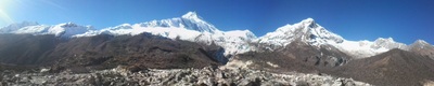
Himalayan sights: Manaslu, Annapurna and Ganesh himal range
Daily Itinerary with,
High altitude,feet,Kilometer and hours of Manasulu trekking in Nepal
(Please Note: If the Below schedule does not meet your need and interest, I can design individualized travel plans based on your preferences.)
(Day 1)-Drive from Kathmandu to Dhading besi (3.5hours), Again Dhading besi to Arughat maximum 2.5 hours and continue to Sotikhola 1.5 hours drive. ( We could start trek from Arughat to sotikhola but we have to walk fully day in dusty jeep road from Arughat to sotikhola so, better to go direct to sotikhola.) 730m. Overnight stay in Sotikhola.
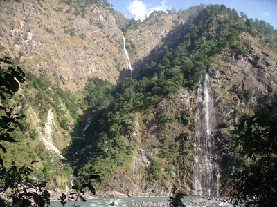
(Day 2)- Trek from Soti Khola to Machha Khola -890m/2952ft.(6hours-16KM) .The zigzag path passes through forest, villages, streams, pretty waterfalls and green valleys until you reach Lapu Besi. This is a village mainly resided by Mongolian inhabitants. You then again traverse the zigzag path to reach Machha Khola. There is a small market with a few shops and lodges. Overnight stay in Machhakhola.
(Day 3) -Trek from Machha Khola to Jagat-1410m/4625ft. (7-8hours-20KM.) It takes about six hours. We can cross the Machha Khola [Fish Stream] and head upstream to the tiny village of Khorla Bensi and the hot springs at Tatopani. The trail is quite exposed and challenging in places. After a short section of forest path we can reach the single teahouse at Doban. At Yuru Khola, you cross the river on a suspension bridge, and then climb on a high path to the fields of Jagat, where you camp. Overnight stay in Jagat.Overnight stay in Jagat.
(Day 4)- -Trek from Jagat to Deng (1800m/5905ft) . This day will be quite long day around 9 hours .The early part of trek moves gently uphill and then follows a flat leveled path. You cross a suspension bridge over Budhi Gandaki before you enter Philim. It takes about three hours for Philim. Philim is a big village mainly inhabited by the Gurungs. From Philim to Deng ,It takes about six hours. You trek over a flat leveled path mostly through forest of pine, rhododendron and others. While walking, you cross a few bridges and can see villages at a far distance. From Deng, you can enjoy a pretty waterfall lying at some distance. Deng is famous for its potatoes, buck wheat, barley, wheat, cabbage and spinach and the people here are mostly involved in agriculture in this area. Overnight stay in in Deng.
(Day 5)-Trek from Deng to Namrung (2660m/8727ft) It takes about seven hours. In the beginning,you trek almost a flat leveled path and then the trail moves uphill all the way to Namrung through forest. Stay in Namrung.
(Day 6)-Trek from Namrung - Lho [3180m/10,430 ft]: 4 - 5 hrs .You trek over a winding path that moves through the inner Himalayan range. On the way, you can enjoy mountain views of Rupinala pass, Mt. Manaslu, Gorkha Himal, Dwijen Himal, Saula Himal, Lajing peak, and many other snow capped mountains and peaks. As you go up the vegetation decreases. You come across Mani walls, chortens, prayer flags and monasteries. Overnight stay in Lho.
(Day 7)-Trek from Lho to Samagaon (3590m/11581ft)It takes about 3.5 hours. we can catch panoramic views of Mt. Manaslu, Gorkha Himal, Dwijen Himal, Saula Himal, Lajing peak .From Lhogaon to Samagaon , we can follow the right bank of the river, with views of Peak 29 ahead. As you continue on the main trail you soon reach the fields of Sama Gaon, 3500m. Stay overnight in Sama Gaon.
(Day 8)- (Rest Day) this is a day for rest at Samagaon to give you some acclimatization. You can hike to Manaslu Base Camp for excellent views of Samdo (Pang phuchuli); Nagdi chuli, Simnang Himal, Manaslu glacier, Manaslu ice fall and you can visit Birendra Kunda which is an ice lake near the Manaslu Base Camp. Stay overnight in samagaon.
(Day 9)-Trek from Samagaon to Samdo(3690m/12106ft)
It takes about four hours.Trek gently uphill all the way to Samdo through a desert path and windy valley. The Tibetan border is just four kilometers away from Samdo. This is an excellent view point for Mt. Manaslu, Samdo (Pang phuchuli), Nagdichuli, Simnang Himal, Manaslu glacier, Manaslu ice fall and several other majestic peaks. Stay overnight in Samdo.
(Day 10)-Trek from Samdo to Larkya La Phedi (4460m/14665ft)It takes about four hours. The trail is rocky and zigzags all the way to our destination. Before we reach Larka La Phedi, there is a market called Larkya Bazaar (market) where seasonal fairs are held for the local folks. We will also find a Dharmasala at Larkya La Phedi. Stay overnight in Larkya La Phedi.
(Day 11)-Trek from Larkya La Phedi to Larkya La (Pass) (5106m/16756ft) to Bimthang (3590 m.) It takes about nine hours. Early in the morning you begin to trek a steep ascent until Larkya La through a rocky and windy path. From here, you can enjoy the views of Larkya peak, Mt. Manaslu, Ratna chuli, Cheo Himal and many other snow capped mountains and peaks. Crossing this pass, we can follow a steep downhill path through rock and ice. On the way, you will encounter many icy lakes. Bimthang is a broad and level ablation valley with a number of Mani walls and deserted houses. From Larkya La you can see four glaciers converging above amazing views to Lamjung Himal and the Annapurnas.Stay overnight in Bimtang.
(Day 12)-Trek from Bimthang to Tilje(2300m/7546ft) - It takes about seven hours. Crossing this high pasture you descend the valley of the Burdin Khola to the area of the Base Camp for the West side of Manaslu. From a ridge at 4150 meters, you have excellent views of Manaslu to the South East and Annapurna II to the South West. Beyond a bridge over the headwaters of the Dudh Khola, we can descend into a rhododendron forest and follow a trail through a narrow valley until we reach the highest cultivated land in this valley at Karche, 2785 meters. Walking down you cross a stream to reach Tilje. Stay overnight in Tilje.
(Day 13)- Trek from Tilje to Jagat (1300m/4256ft)It takes about six hours. . Leaving Tilje, Our trek uphill for nearly one hours and reach Dharapani crossing a bridge over the Marshyangdi River. Our trek all the way over a descended path along the bank of Dudh Khola (river) and Marshyangdi River. On the way, we walk through pleasant villages such as Tal, which is an attractive village with a pretty waterfall. Eventually, we can come across Jagat, which is a stone village situated on a shelf, that juts into the precipitous Marsyangdi valley. stay overnight in Jagat.
(Day 14)- Jaget to Bulbule
(Day 15)- - Bulbule to Besishar by jeep or Bus and again next bus to Pokhara
Tulasi Ram Paudel
(Professional independent trekking guide in Nepal)
Mail:[email protected]
websites: www.trekguidenepal.weebly.com
www.trekwithguide.blogspot.com
www.facebook.com/trekguidetulasi
click here contact form / booking form
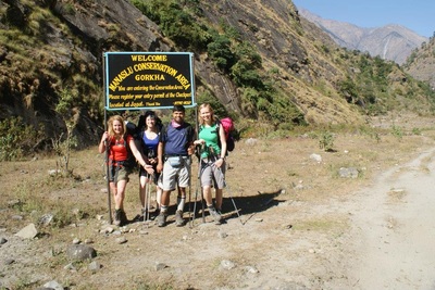
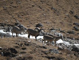
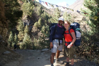
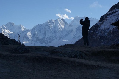
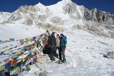
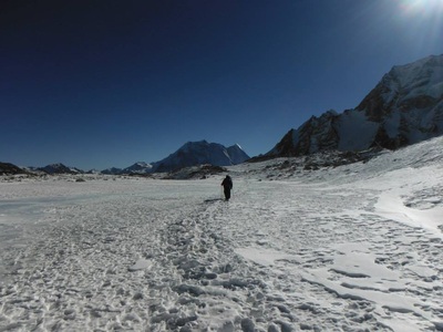
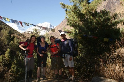
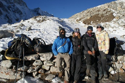
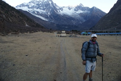
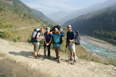
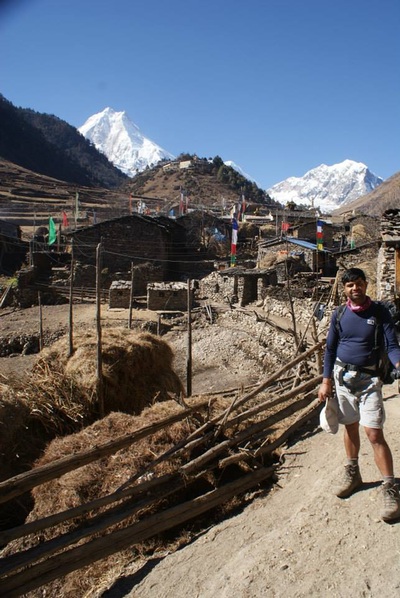
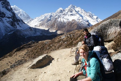
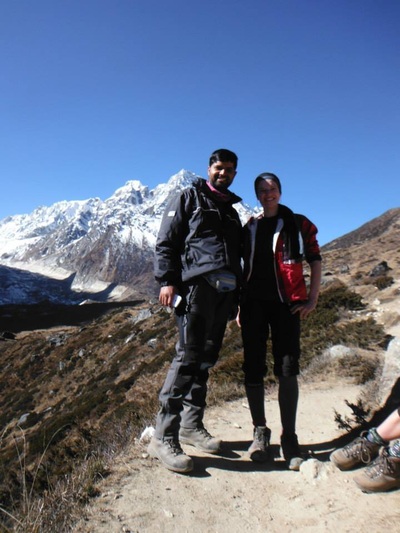
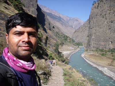
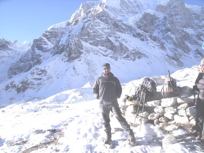
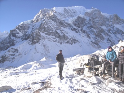
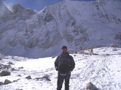
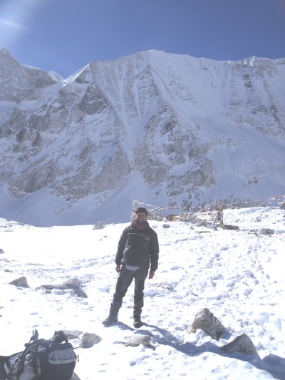
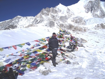
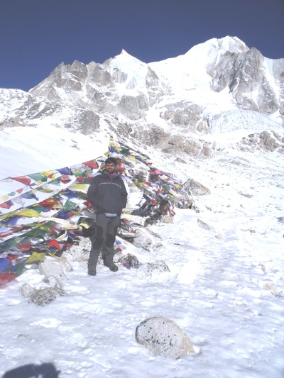
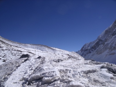
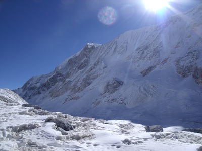
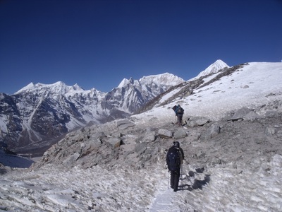
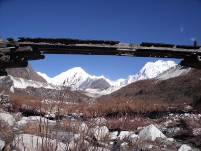
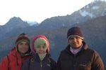
Photos gallery of Manasulu circuit trekking in Nepal
Manasulu trekking in Nepal
Manaslu trek is adventure trek in Nepal. The trail is rough and steep; literally hanging on a bluff high above the river.This trek is now an alternative to the Annapurna circuit trek due to road access in Annapurna. The main journey here is around Manaslu, reaching north of the Himalayas and circling the great Manaslu-Himalchuli-Baudha massif. Since Manaslu is a special area for trekkers and was only officially opened from 1991 onwards for trekking, it needs special permits. Two-week complete treks will give you an exciting, adventurous and once in a lifetime experience. We use camping before but now we have tea house trek in Manasulu.
Duration of the trek: 15-18 Days
Maximum elevation :Larkya La Pass (5106m/16756ft).
Trek grade :Easy to Difficult.
Accommodations: Tea House or fully camping
Minimum Group Size:2
Itinerary type Fixed Best Season February, March, April, May, June, July, August, September,October, November
Per day Walking: 3 to 9 hours
Himalayan sights: Manaslu, Annapurna and Ganesh himal range
Daily Itinerary with,
High altitude,feet,Kilometer and hours of Manasulu trekking in Nepal
(Please Note: If the Below schedule does not meet your need and interest, I can design individualized travel plans based on your preferences.)
(Day 1)-Drive from Kathmandu to Dhading besi (3.5hours), Again Dhading besi to Arughat maximum 2.5 hours and continue to Sotikhola 1.5 hours drive. ( We could start trek from Arughat to sotikhola but we have to walk fully day in dusty jeep road from Arughat to sotikhola so, better to go direct to sotikhola.) 730m. Overnight stay in Sotikhola.
(Day 2)- Trek from Soti Khola to Machha Khola -890m/2952ft.(6hours-16KM) .The zigzag path passes through forest, villages, streams, pretty waterfalls and green valleys until you reach Lapu Besi. This is a village mainly resided by Mongolian inhabitants. You then again traverse the zigzag path to reach Machha Khola. There is a small market with a few shops and lodges. Overnight stay in Machhakhola.
(Day 3) -Trek from Machha Khola to Jagat-1410m/4625ft. (7-8hours-20KM.) It takes about six hours. We can cross the Machha Khola [Fish Stream] and head upstream to the tiny village of Khorla Bensi and the hot springs at Tatopani. The trail is quite exposed and challenging in places. After a short section of forest path we can reach the single teahouse at Doban. At Yuru Khola, you cross the river on a suspension bridge, and then climb on a high path to the fields of Jagat, where you camp. Overnight stay in Jagat.Overnight stay in Jagat.
(Day 4)- -Trek from Jagat to Deng (1800m/5905ft) . This day will be quite long day around 9 hours .The early part of trek moves gently uphill and then follows a flat leveled path. You cross a suspension bridge over Budhi Gandaki before you enter Philim. It takes about three hours for Philim. Philim is a big village mainly inhabited by the Gurungs. From Philim to Deng ,It takes about six hours. You trek over a flat leveled path mostly through forest of pine, rhododendron and others. While walking, you cross a few bridges and can see villages at a far distance. From Deng, you can enjoy a pretty waterfall lying at some distance. Deng is famous for its potatoes, buck wheat, barley, wheat, cabbage and spinach and the people here are mostly involved in agriculture in this area. Overnight stay in in Deng.
(Day 5)-Trek from Deng to Namrung (2660m/8727ft) It takes about seven hours. In the beginning,you trek almost a flat leveled path and then the trail moves uphill all the way to Namrung through forest. Stay in Namrung.
(Day 6)-Trek from Namrung - Lho [3180m/10,430 ft]: 4 - 5 hrs .You trek over a winding path that moves through the inner Himalayan range. On the way, you can enjoy mountain views of Rupinala pass, Mt. Manaslu, Gorkha Himal, Dwijen Himal, Saula Himal, Lajing peak, and many other snow capped mountains and peaks. As you go up the vegetation decreases. You come across Mani walls, chortens, prayer flags and monasteries. Overnight stay in Lho.
(Day 7)-Trek from Lho to Samagaon (3590m/11581ft)It takes about 3.5 hours. we can catch panoramic views of Mt. Manaslu, Gorkha Himal, Dwijen Himal, Saula Himal, Lajing peak .From Lhogaon to Samagaon , we can follow the right bank of the river, with views of Peak 29 ahead. As you continue on the main trail you soon reach the fields of Sama Gaon, 3500m. Stay overnight in Sama Gaon.
(Day 8)- (Rest Day) this is a day for rest at Samagaon to give you some acclimatization. You can hike to Manaslu Base Camp for excellent views of Samdo (Pang phuchuli); Nagdi chuli, Simnang Himal, Manaslu glacier, Manaslu ice fall and you can visit Birendra Kunda which is an ice lake near the Manaslu Base Camp. Stay overnight in samagaon.
(Day 9)-Trek from Samagaon to Samdo(3690m/12106ft)
It takes about four hours.Trek gently uphill all the way to Samdo through a desert path and windy valley. The Tibetan border is just four kilometers away from Samdo. This is an excellent view point for Mt. Manaslu, Samdo (Pang phuchuli), Nagdichuli, Simnang Himal, Manaslu glacier, Manaslu ice fall and several other majestic peaks. Stay overnight in Samdo.
(Day 10)-Trek from Samdo to Larkya La Phedi (4460m/14665ft)It takes about four hours. The trail is rocky and zigzags all the way to our destination. Before we reach Larka La Phedi, there is a market called Larkya Bazaar (market) where seasonal fairs are held for the local folks. We will also find a Dharmasala at Larkya La Phedi. Stay overnight in Larkya La Phedi.
(Day 11)-Trek from Larkya La Phedi to Larkya La (Pass) (5106m/16756ft) to Bimthang (3590 m.) It takes about nine hours. Early in the morning you begin to trek a steep ascent until Larkya La through a rocky and windy path. From here, you can enjoy the views of Larkya peak, Mt. Manaslu, Ratna chuli, Cheo Himal and many other snow capped mountains and peaks. Crossing this pass, we can follow a steep downhill path through rock and ice. On the way, you will encounter many icy lakes. Bimthang is a broad and level ablation valley with a number of Mani walls and deserted houses. From Larkya La you can see four glaciers converging above amazing views to Lamjung Himal and the Annapurnas.Stay overnight in Bimtang.
(Day 12)-Trek from Bimthang to Tilje(2300m/7546ft) - It takes about seven hours. Crossing this high pasture you descend the valley of the Burdin Khola to the area of the Base Camp for the West side of Manaslu. From a ridge at 4150 meters, you have excellent views of Manaslu to the South East and Annapurna II to the South West. Beyond a bridge over the headwaters of the Dudh Khola, we can descend into a rhododendron forest and follow a trail through a narrow valley until we reach the highest cultivated land in this valley at Karche, 2785 meters. Walking down you cross a stream to reach Tilje. Stay overnight in Tilje.
(Day 13)- Trek from Tilje to Jagat (1300m/4256ft)It takes about six hours. . Leaving Tilje, Our trek uphill for nearly one hours and reach Dharapani crossing a bridge over the Marshyangdi River. Our trek all the way over a descended path along the bank of Dudh Khola (river) and Marshyangdi River. On the way, we walk through pleasant villages such as Tal, which is an attractive village with a pretty waterfall. Eventually, we can come across Jagat, which is a stone village situated on a shelf, that juts into the precipitous Marsyangdi valley. stay overnight in Jagat.
(Day 14)- Jaget to Bulbule
(Day 15)- - Bulbule to Besishar by jeep or Bus and again next bus to Pokhara
Tulasi Ram Paudel
(Professional independent trekking guide in Nepal)
Mail:[email protected]
websites: www.trekguidenepal.weebly.com
www.trekwithguide.blogspot.com
www.facebook.com/trekguidetulasi
click here contact form / booking form
Photos gallery of Manasulu circuit trekking in Nepal