Nar-Phu vally trekking in Nepal
Nar-Phu vally trekking in nepal, Nar-Phu vally, Nar Phu Trek, Trek guide in Nepal, Independent trek guide in Nepal, Freelancer trek guide in Nepal, Professional trekking guide in Nepal, Local trekking guide from pokhara, trek guide from pokhara, best trekking guide from Nepal, trekking in himalayan, himalayan trek guide in Nepal, probably the best trekkin guide in Nepal, trek in Nepal, wildlife guide in Nepal, sightseeing guide from pokhara, Nepal freelance guides and porters,Trekking from Pokhara.
Nar Phu Vally Trekking in Nepal:
Max.elevation : 5416m
Type of trek : Moderate+challange(Tea house and camping )
Duration of day :16-21days
Duration a day walking:3-8 hours
Nar-phu vally trekking in nepal, is remote valley left untouched by civilizations enter from near Chame, on the trail of popular Annupurna trek. Exploring the valley to the north, visiting Phu village situated on the edge, we travel south to Nar VillageThis is probably the best trek of Annapurna region and for those who want to explore hidden valley and trek off the beaten crossing through Challenging high passes like Masokanto La (5099m), Kangla pass (5200m) & Tilicho Pass (5230m) with beautiful Lake Tilicho. Hidden by swirls of mountain mist ahead of us, from Kangla pass at 5200m the magnificent panorama view of Annapurna massif appears remote and forbidding.Our destination is the Nar-Phu valley, above the tree line on the upper limits of cultivation, in the very north of Manang district. It takes five hours reaching the pass that links Nar with Manang and three other Bhotia villages in the Nyershang down valley. Nowadays, Nar Phu has about 300 inhabitants who depend on livestock, unlike most Bhotia people, whose trading patterns changed drastically after the Nepali Government closed borders with Tibet, the people of Nar and Phu valley were least affected by this change. The tortuous path leading from the valley into Tibet had never made them dependent on the salt trade, and till today yak herding is the basis of their livelihood.The Nepal government''''s recent decision to open up Nar and Phu to tourists has evoked little enthusiasm among the villagers, whose pastoral lifestyle continues. Apart from the odd researcher and climbing expeditions permitted to climb Him lung, Ratnachuli and Gachikang, few foreigners has visited the area and tourism infrastructure is almost non-existent.Since , Annapurna Conservation Area Project (ACAP) recently extended its network to include Nar and Phu Valley, it is preparing a suitable tourism development plan at the request of the government for undiscovered valley. We start this trek after driving almost whole day from Kathmandu to Besishar. From here we follow Pupular Annapurna Circuit route until Koto and then we take off the beatan route until we get Nar Phu. After visiting this area we trek back to manang, a beautiful village of Annapurna trail and continue trek to Tilicho route. After trekking about 4-5 days through Tilicho Lake and two beautiful but challenging pass of this region we end our trek at Jomsom where we catch our flight to Pokhara and later to KTM. Trekkers carry only day pack and walk at their own pace.
Itinearay:
(Please Note: If the Below schedule does not meet your need and interest, I can design individualized travel plans based on your preferences.)
Day 01: Your arrival to Tribhuwan International Airport (TIA) Green Valley Nepal Treks airport representative well come to pick up you at Kathmandu International Airport then transfer to your Hotel. At evening we discuses about Annapurna Circuit Trek then we offer you well come dinner in Traditional Nepali restaurant.
Day 02: Drive Kathmandu to Besisahar 790m. Drive from Kathmandu to Besisahar takes about 6-7 hours with local bus or by private couch because there isn’t tourist bus. At evening you could have a walk around Besisahar. Besisahar is center of Lamjung district.
Day 03: Besishahar to Bahundanda (1310m). Annapurna Circuit Trek starts from Besishahar, the trail makes ascend to Khudi Village at 790m, then reach the first Gurung village as we continue from Khudi the trail offers fine views of Himalchuli and Peak 29 (Ngadi Chuli). Trekking trail continues ascends to Bhulbhule at 825m. Its goes through Ngadi, Lampata at 1135m and Bahundanda at 1310m.
Day 04: Bahundanda to Chyamje (1400m). Today the trail drops sharply to Syange at 1070m from Bahundanda crossing the Marsyangdi River on a suspension bridge. We then follow the river to the stone village of Jagat before climbing
through forest to Chyamje at 1400m.Overnight at Guest House.
Day 05: Chyamje to Bagarchhap (2160m). The day begins with the rocky trail following the Marsyandi Rivers progressively uphill to Tal at 1675m, the first village in the Manang district. We make a trail poetry crossing a extensive, flat valley. The trail then ascends a stone staircase to 1860m till another stairway. The journey continues making up and down to Dharapani at 1890m. There we find a stone entrance chorten typical of the Tibetan prejudiced villages from here northwards. We then visit the Bagarchhap at 2160m that offers the typical flat covered stone houses of local Tibetans design although the village which is still in the conversion Zone before the dry highlands. Overnight at Guest House.
Day06: Bagarchhap to Koto (2600m). With often rough and rocky, the trail climbs to Timang at 2360m, then continues through forest, but near the river, to Kopar at 2590m. As we get to the Koto, you can satisfied by the fine views of Annapurna II , Overnight at Guest House.
Day 07: Koto – Dharamshala (6h-3230m) and O/n at tented camp or basic teahouse.
Day 08: Dharamshala – Kyang (5h-3740m) and O/n at tented camp or basic teahouse.
Day 09: Kyang – Phu Gaon (6h-4050m) and O/n at tented camp or basic teahouse.
Day 10: Phu Gaon – Mahendra pool (6h-3600m) and O/n at tented camp or basic teahouse.
Day 11: Mahendra pool – Naar Gaon (and O/n at tented camp or basic teahouse.
Day 12: Naar Gaon – Kang – La phedi (5h-4530m) and O/n at tented camp or basic teahouse.
Day 13: Kang-La Phedi –Kang-La Pass(5322m)–Ngawal (7h-3680m) and O/n at tented camp or basic teahouse.
Day 14:Nagwal to Manang (3500m). Today we continue through the upper part of the Manang district, the full effect of the monsoon by the Annapurna Range. People of this region, herd yaks & raise crops for part of the year in addition, they also continue to enjoy special trading rights gained way back in 1784. we have an alternate trails north and south of the Marsyangdi River which meet up again at Mungji (upper trails from Pisang-Nagwal-Manang). The southern route by Hongde, with its airstrip, at 3325m involves less climbing than the northern route via Ghyaru, though there are better views on the trail that follows the northern bank of the river. From Mungji, the trail continues past the picturesque but partially hidden village of Bryanga at 3475m to nearby Manang at 3500m.Overnight at Guest House.
Day 15: Manang Rest Acclimatization day Today we spend a day acclimatizing in Manang. The whole day we spend by doing some fine day walks and over viewing the wonderful views around the village & the day time is best to gain altitude. At the end of the day, we return back to our accommodation & have a night rest. Overnight at Guest House.
Day 16: Manang to Ledar (4250m). Today we leave Manang, & the trail makes an ascent of nearly 2000m to the Thorung La pass. We make the ascend progressively through Tenki, leaving the Marsyangi Valley. Continuing along the Jarsang Khola Valley, we reach Ledar at 4250m.Overnight at Guest House.
Day 17: Ledar to Phedi or High camp (4600m). The trail descends to cross the river at 4310m we then ascend up to Phedi at 4420m. At High Camp on the elevation of 4600m, we can recently found some good Guesthouses built. Your overnight stay will be there. Overnight at Guest House.
Day 18: Phedi or High Camp to Muktinath (3710m). The journey from Phedi "foot of the hill" or at the foot to the 5416m Thorung La pass, starts the day. We then make the climb steeply that is regularly used and easy to follow. However, the problem may occur due to the altitude and snow. It often causes terrible problem to cross the pass if it is covered by snow. About four hours climb up to the pass marked by the chortens & prayer flags. As you reach the top, you are rewarded by the magnificent view from the top. Overnight at Guest House.
Day 19: Trek to Jomsom (2713m.). Treks ends here. Overnight at Guest House.
Jomsom with beautiful snow mountains and no tree land ! It is gateway of Mustang trek. Those, having not good enough time to trek down all the way to Pokhra can fly to Pokhara-Kathmandu on the next day.
Day 20: Fly back to Pokhara (about 20 minute's short, but scenic flight). Overnight at hotel.
Day 21: Drive back to Kathmandu by Toursit Bus - about 6-7 hours scenic drive.
Or
.
Day 20:Jomsom to Tukuche (2591 m.) 5/6 hrs. walk a valley dominated by Thakalis, Gurungs and Magars tribes, lunch at Marfa on the way.
Day 21:Tukuche to Ghasa (1970 m.) 5/6 hrs walk, a dramatic change in the surrounding with green vegetation and very beautiful view of Dhaulagiri and Annapurna region. Overnight at Ghasa.
Day 22: Ghasa to Tatopani (1189 m.) 5/6 hours walk, gradual descend to Tatopani through valleys, fields and the beautiful Rupse Chhahara (water falls) and then the time to have lunch at Dana village which is the deepest gorge in the world. Rest and overnight at Tatopani.
Day 23: Tatopani to Ghorepani (2793 m.) 6/7 hrs. walk, A challenging ascent upto Ghorepani. Lunch at Sikha village, and overnight at Ghorepani from where one can observe the best sun set view over the profile of Mt. Dhaulagiri and Annapurna.
Day 24:Rest at Ghorepani and Excursion to the Poon Hill The highest hill in the west in the whole trek , bird- eye view of Mustang and Pokhara valleys, also provides clear view of 30 snow-capped peaks including the Annapurna range and Dhaulagiri. Or walk to Tadapani at the afternoon for 4 hrs.
Day 25:Ghorepani/Tadapani to Ghandrung (1951 m.) 6/3 hours, with ups and downs towards Tadapani for lunch and camp at Ghandrung which is the biggest Gurung settlement with a closer view of Annapurna, Machhapuchhre and Hiunchuli.
Day 26:Ghandrung to Birethati (5/6 hours, walk downwards to Modi river) and drive back to Pokhara.
For more details ,
contract: Tulasi Ram Paudel
Mail: [email protected] / [email protected]
websites:www.trekguidenepal.weebly.com
www.trekwithguide.blogspot.com
www.facebook.com/trekguidetulasi
Mobile or whatapp:00977-9846058846
Tipadvisor: Professional freelancer trekking guide in Pokhara, Nepal
https://www.tripadvisor.com/Attraction_Review-g293891-d4722808-Reviews-Professional_Freelancer_Trekking_Guide-Pokhara_Gandaki_Zone_Western_Region.html
click here for : contact form/booking form
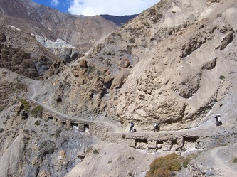
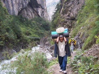
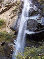
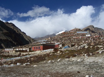
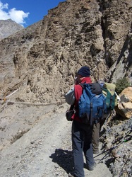
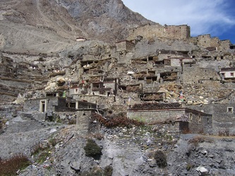
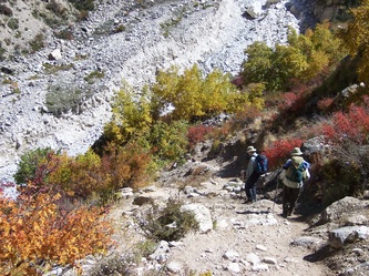
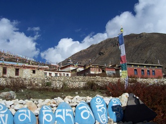
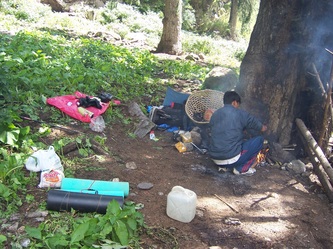
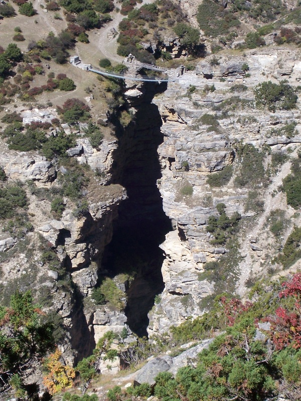
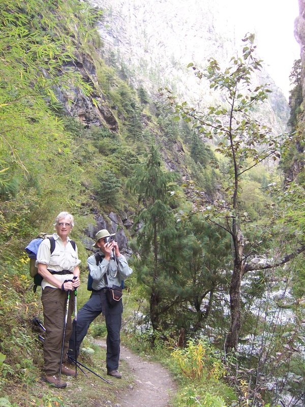
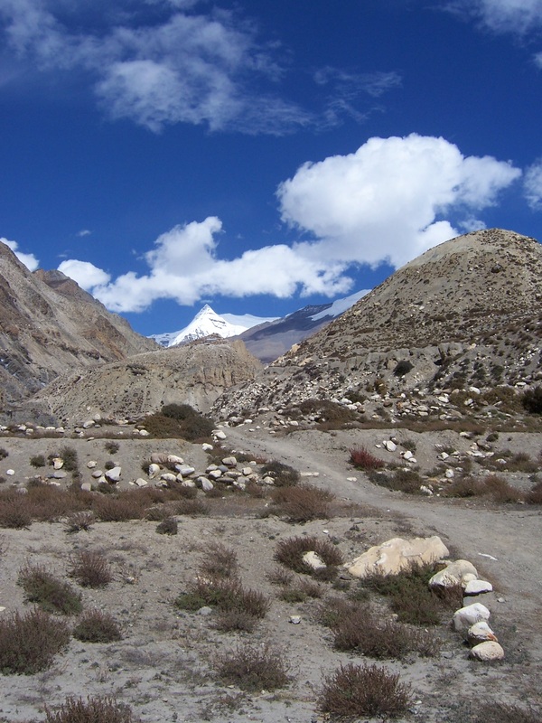
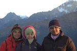
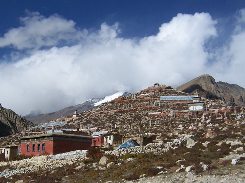
Photos gallery of Nar-phu vally trek :
Nar Phu Vally Trekking in Nepal:
Max.elevation : 5416m
Type of trek : Moderate+challange(Tea house and camping )
Duration of day :16-21days
Duration a day walking:3-8 hours
Nar-phu vally trekking in nepal, is remote valley left untouched by civilizations enter from near Chame, on the trail of popular Annupurna trek. Exploring the valley to the north, visiting Phu village situated on the edge, we travel south to Nar VillageThis is probably the best trek of Annapurna region and for those who want to explore hidden valley and trek off the beaten crossing through Challenging high passes like Masokanto La (5099m), Kangla pass (5200m) & Tilicho Pass (5230m) with beautiful Lake Tilicho. Hidden by swirls of mountain mist ahead of us, from Kangla pass at 5200m the magnificent panorama view of Annapurna massif appears remote and forbidding.Our destination is the Nar-Phu valley, above the tree line on the upper limits of cultivation, in the very north of Manang district. It takes five hours reaching the pass that links Nar with Manang and three other Bhotia villages in the Nyershang down valley. Nowadays, Nar Phu has about 300 inhabitants who depend on livestock, unlike most Bhotia people, whose trading patterns changed drastically after the Nepali Government closed borders with Tibet, the people of Nar and Phu valley were least affected by this change. The tortuous path leading from the valley into Tibet had never made them dependent on the salt trade, and till today yak herding is the basis of their livelihood.The Nepal government''''s recent decision to open up Nar and Phu to tourists has evoked little enthusiasm among the villagers, whose pastoral lifestyle continues. Apart from the odd researcher and climbing expeditions permitted to climb Him lung, Ratnachuli and Gachikang, few foreigners has visited the area and tourism infrastructure is almost non-existent.Since , Annapurna Conservation Area Project (ACAP) recently extended its network to include Nar and Phu Valley, it is preparing a suitable tourism development plan at the request of the government for undiscovered valley. We start this trek after driving almost whole day from Kathmandu to Besishar. From here we follow Pupular Annapurna Circuit route until Koto and then we take off the beatan route until we get Nar Phu. After visiting this area we trek back to manang, a beautiful village of Annapurna trail and continue trek to Tilicho route. After trekking about 4-5 days through Tilicho Lake and two beautiful but challenging pass of this region we end our trek at Jomsom where we catch our flight to Pokhara and later to KTM. Trekkers carry only day pack and walk at their own pace.
Itinearay:
(Please Note: If the Below schedule does not meet your need and interest, I can design individualized travel plans based on your preferences.)
Day 01: Your arrival to Tribhuwan International Airport (TIA) Green Valley Nepal Treks airport representative well come to pick up you at Kathmandu International Airport then transfer to your Hotel. At evening we discuses about Annapurna Circuit Trek then we offer you well come dinner in Traditional Nepali restaurant.
Day 02: Drive Kathmandu to Besisahar 790m. Drive from Kathmandu to Besisahar takes about 6-7 hours with local bus or by private couch because there isn’t tourist bus. At evening you could have a walk around Besisahar. Besisahar is center of Lamjung district.
Day 03: Besishahar to Bahundanda (1310m). Annapurna Circuit Trek starts from Besishahar, the trail makes ascend to Khudi Village at 790m, then reach the first Gurung village as we continue from Khudi the trail offers fine views of Himalchuli and Peak 29 (Ngadi Chuli). Trekking trail continues ascends to Bhulbhule at 825m. Its goes through Ngadi, Lampata at 1135m and Bahundanda at 1310m.
Day 04: Bahundanda to Chyamje (1400m). Today the trail drops sharply to Syange at 1070m from Bahundanda crossing the Marsyangdi River on a suspension bridge. We then follow the river to the stone village of Jagat before climbing
through forest to Chyamje at 1400m.Overnight at Guest House.
Day 05: Chyamje to Bagarchhap (2160m). The day begins with the rocky trail following the Marsyandi Rivers progressively uphill to Tal at 1675m, the first village in the Manang district. We make a trail poetry crossing a extensive, flat valley. The trail then ascends a stone staircase to 1860m till another stairway. The journey continues making up and down to Dharapani at 1890m. There we find a stone entrance chorten typical of the Tibetan prejudiced villages from here northwards. We then visit the Bagarchhap at 2160m that offers the typical flat covered stone houses of local Tibetans design although the village which is still in the conversion Zone before the dry highlands. Overnight at Guest House.
Day06: Bagarchhap to Koto (2600m). With often rough and rocky, the trail climbs to Timang at 2360m, then continues through forest, but near the river, to Kopar at 2590m. As we get to the Koto, you can satisfied by the fine views of Annapurna II , Overnight at Guest House.
Day 07: Koto – Dharamshala (6h-3230m) and O/n at tented camp or basic teahouse.
Day 08: Dharamshala – Kyang (5h-3740m) and O/n at tented camp or basic teahouse.
Day 09: Kyang – Phu Gaon (6h-4050m) and O/n at tented camp or basic teahouse.
Day 10: Phu Gaon – Mahendra pool (6h-3600m) and O/n at tented camp or basic teahouse.
Day 11: Mahendra pool – Naar Gaon (and O/n at tented camp or basic teahouse.
Day 12: Naar Gaon – Kang – La phedi (5h-4530m) and O/n at tented camp or basic teahouse.
Day 13: Kang-La Phedi –Kang-La Pass(5322m)–Ngawal (7h-3680m) and O/n at tented camp or basic teahouse.
Day 14:Nagwal to Manang (3500m). Today we continue through the upper part of the Manang district, the full effect of the monsoon by the Annapurna Range. People of this region, herd yaks & raise crops for part of the year in addition, they also continue to enjoy special trading rights gained way back in 1784. we have an alternate trails north and south of the Marsyangdi River which meet up again at Mungji (upper trails from Pisang-Nagwal-Manang). The southern route by Hongde, with its airstrip, at 3325m involves less climbing than the northern route via Ghyaru, though there are better views on the trail that follows the northern bank of the river. From Mungji, the trail continues past the picturesque but partially hidden village of Bryanga at 3475m to nearby Manang at 3500m.Overnight at Guest House.
Day 15: Manang Rest Acclimatization day Today we spend a day acclimatizing in Manang. The whole day we spend by doing some fine day walks and over viewing the wonderful views around the village & the day time is best to gain altitude. At the end of the day, we return back to our accommodation & have a night rest. Overnight at Guest House.
Day 16: Manang to Ledar (4250m). Today we leave Manang, & the trail makes an ascent of nearly 2000m to the Thorung La pass. We make the ascend progressively through Tenki, leaving the Marsyangi Valley. Continuing along the Jarsang Khola Valley, we reach Ledar at 4250m.Overnight at Guest House.
Day 17: Ledar to Phedi or High camp (4600m). The trail descends to cross the river at 4310m we then ascend up to Phedi at 4420m. At High Camp on the elevation of 4600m, we can recently found some good Guesthouses built. Your overnight stay will be there. Overnight at Guest House.
Day 18: Phedi or High Camp to Muktinath (3710m). The journey from Phedi "foot of the hill" or at the foot to the 5416m Thorung La pass, starts the day. We then make the climb steeply that is regularly used and easy to follow. However, the problem may occur due to the altitude and snow. It often causes terrible problem to cross the pass if it is covered by snow. About four hours climb up to the pass marked by the chortens & prayer flags. As you reach the top, you are rewarded by the magnificent view from the top. Overnight at Guest House.
Day 19: Trek to Jomsom (2713m.). Treks ends here. Overnight at Guest House.
Jomsom with beautiful snow mountains and no tree land ! It is gateway of Mustang trek. Those, having not good enough time to trek down all the way to Pokhra can fly to Pokhara-Kathmandu on the next day.
Day 20: Fly back to Pokhara (about 20 minute's short, but scenic flight). Overnight at hotel.
Day 21: Drive back to Kathmandu by Toursit Bus - about 6-7 hours scenic drive.
Or
.
Day 20:Jomsom to Tukuche (2591 m.) 5/6 hrs. walk a valley dominated by Thakalis, Gurungs and Magars tribes, lunch at Marfa on the way.
Day 21:Tukuche to Ghasa (1970 m.) 5/6 hrs walk, a dramatic change in the surrounding with green vegetation and very beautiful view of Dhaulagiri and Annapurna region. Overnight at Ghasa.
Day 22: Ghasa to Tatopani (1189 m.) 5/6 hours walk, gradual descend to Tatopani through valleys, fields and the beautiful Rupse Chhahara (water falls) and then the time to have lunch at Dana village which is the deepest gorge in the world. Rest and overnight at Tatopani.
Day 23: Tatopani to Ghorepani (2793 m.) 6/7 hrs. walk, A challenging ascent upto Ghorepani. Lunch at Sikha village, and overnight at Ghorepani from where one can observe the best sun set view over the profile of Mt. Dhaulagiri and Annapurna.
Day 24:Rest at Ghorepani and Excursion to the Poon Hill The highest hill in the west in the whole trek , bird- eye view of Mustang and Pokhara valleys, also provides clear view of 30 snow-capped peaks including the Annapurna range and Dhaulagiri. Or walk to Tadapani at the afternoon for 4 hrs.
Day 25:Ghorepani/Tadapani to Ghandrung (1951 m.) 6/3 hours, with ups and downs towards Tadapani for lunch and camp at Ghandrung which is the biggest Gurung settlement with a closer view of Annapurna, Machhapuchhre and Hiunchuli.
Day 26:Ghandrung to Birethati (5/6 hours, walk downwards to Modi river) and drive back to Pokhara.
For more details ,
contract: Tulasi Ram Paudel
Mail: [email protected] / [email protected]
websites:www.trekguidenepal.weebly.com
www.trekwithguide.blogspot.com
www.facebook.com/trekguidetulasi
Mobile or whatapp:00977-9846058846
Tipadvisor: Professional freelancer trekking guide in Pokhara, Nepal
https://www.tripadvisor.com/Attraction_Review-g293891-d4722808-Reviews-Professional_Freelancer_Trekking_Guide-Pokhara_Gandaki_Zone_Western_Region.html
click here for : contact form/booking form
Photos gallery of Nar-phu vally trek :